
nanoCAD 3DScan is specialized software designed for processing 3D scanning data and tackling engineering and informational challenges across fields such as geodesy, mechanical engineering, construction, infrastructure, and metrological monitoring. It operates as a downloadable vertical application on the nanoCAD platform.
Download nowThree-dimensional modeling, including simulation;
Support for Building Information Modeling (BIM)
Construction and operation of engineering structures.
Design of machines and mechanisms
Creation of 2.5D drawings and plans;
Populating GIS systems.
Modeling transportation tasks;
Author's supervision.

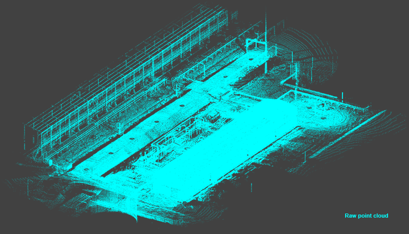
3D scanning is essential for analyzing the shape and position of real-world objects in fields like design, industrial modernization, topography, and construction.
nanoCAD 3DScan offers a robust set of tools for working with point clouds, addressing a wide range of challenges in data processing:
nanoCAD can be used on its own as a cost-effective DWG-editor, or customized with essential modules: Construction, Mechanica, Raster, Topoplan and 3D Solid Modeling.

Lot B6-X3. My Dinh 1 Urban Area
Cau Dien, Nam Tu Liem, Hanoi.

097 196 0055
Mon-Fri 8am-5pmGet Subscribed!


